 "The Graveyard of the Gulf "
By Terry Dwyer
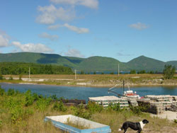
St. Paul Island is located approximately 14 miles northeast of the northern tip of Cape Breton Island, Nova Scotia, and 40 miles southwest of Cape Ray, Newfoundland on Canada's rugged East Coast. This island is commonly referred to as the "Graveyard of the Gulf". The island lies at the entrance to the Gulf of St. Lawrence, the gateway to Upper Canada. St. Paul Island is known to be the second most dangerous island in northeast Canada, possibly in all of northeast North America. Its layout is the complete opposite of the shifting sandy dunes of Sable Island. Instead, razor sharp, jagged rocks, concealed by mist and swell, guard every approach to St. Paul Island.
The island is only three miles long and one mile wide. It is a mountainous island with high cliffs and there are only two areas on the island where a safe landing can be negotiated. The frigid water surrounding the island drops off quite rapidly near shore. The variable tidal streams and currents add to the danger arising from the ever-present fog. St. Paul Island is subject to dramatic and unpredictable weather, there are sudden rain and snow squalls and the wind can change direction without any warning as often as five times in one day. On most days through out the year the entire island is shrouded in a blanket of haunting fog and mist. In short, this rocky outcrop can be a mariner's worst nightmare.
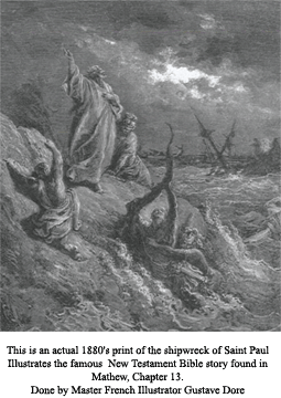
 Early records seem to indicate that St. Paul Island was discovered and named by John Cabot in 1497. It may even have derived its name partially from Saint Paul whom, while on his way to Rome as a prisoner in the year 60 AD, was shipwrecked on the island of Malta at a place known today as St. Paul's Bay. For this reason he is considered to be the paitron saint of shipwrecked sailors.
The island has an ominous history that is filled with actual events of unimaginable terror and disaster. There are over 350 recorded shipwrecks and several thousand people buried on the island in unmarked graves. Many immigrant ships on route from Ireland and England wrecked on St. Paul Island. On board these packed vessels were hundreds of families and all their personal possessions.
For many of them the promise of a New World meant an early grave. In the last 300 years of sea faring, no one knows for sure how many additional ships simply disappeared or were wrecked on St. Paul Island with no one nearby to offer assistance, or to even to know they disappeared into the depths of the Atlantic.
The land surrounding Atlantic Cove would be but a huge cemetery if stones marked all the graves that are scattered there. Unfortunately, there are no such markers, or even crosses, left to identify the thousands who are buried there. If you look closely however, there are some signs that indicate the presence of graves.
 A short distance to the northeast of Atlantic Cove, and on somewhat high ground, a cemetery is located, marked by the ruins of an old fence. Buried in this plot lie the remains of 199 passengers and crew from the British Transport ship, "SOVEREIGN" wrecked on October 18, 1814. The "SOVEREIGN" was en route from England to Quebec. She had on board 186 soldiers, 9 officers, 2 servants, 21 women, 19 crew and a sizable cargo of Mexican silver dollars. Only thirty-seven people lived to tell the tale. So many bodies washed ashore from the "SOVEREIGN" that extra men were brought in from the mainland to partake in the gruesome recovery work.
On the southeast side of Atlantic Cove lies a fairly flat stretch of land that contains the graves of over 300 Irish immigrants whose ship the "SIBYLLE", bound from Cromarty, Ireland to Quebec, wrecked on St. Paul Island on September 11, 1834. It was said that in order to bury the dead, long trenches were dug and a sort of wholesale burial was carried out.
If you look closely at a map of St. Paul Island, very near where the Southwest light now stands, there is a place called "JESSIE COVE". So named after the three masted barque "JESSIE" out of Prince Edward Island, which wrecked on St. Paul Island during a violent snowstorm on January 1st, 1825.  Miraculously the entire crew and passengers survived the shipwreck. They managed to climb the jagged ice covered rocks in a blinding snowstorm, in sub zero conditions and make their way to land, clutching what scarce provisions they could salvage from the wreck. In an attempt to attract the attention of the people living in Cape North, the survivors built great fires made from driftwood and wreckage night after night. A few stragglers saw these signals of distress, but they were powerless.
The "Gulf of St. Lawrence" had become blocked with heavy pack ice a few days after the ship went ashore, hence no friendly vessel passed near the Island until death had claimed them all. The ship's owner a Mr. Mac Kay was on board when the "JESSIE" wrecked. Mr. Mac Kay kept a journal in which he recorded the harsh sufferings and tragic demise of the crew. (Part of this journal may be viewed today in the Historical Museum of Boston Mass.) The last entry was made on March 17, 1825, two and one half months after the "JESSIE" had wrecked. Mr. Mac Kay was the last person to die. In a cruel twist of fate, twenty-three men had been saved from a cold and watery grave only to die a more horrifying and unspeakable death from starvation and exposure while they waited for help- that never came. What private and personal hell each man must have went through.
 How the saga of the "JESSIE" became known is even more remarkable. In the early 1800's, in April of each year, French fishermen from Cheticamp and the Magdalen Islands went over the ice seal hunting. They used to call upon St. Paul Island to specifically salvage shipwrecks that may have occurred over the winter. A vessel from Cheticamp visited St. Paul Island and found the dead bodies of the crew of the "JESSIE". The owner Mac Kay, who was the last one to die, was wrapped in a richly made cloak and this was taken off the body. In the fall of that year one of the fisherman visited Charlottetown, wearing Mac Kay's cloak. The widow of Mr. Mac Kay met him on the street, recognized her husband's coat, pulled it open and inside found her husband's initials sewn in by her very own hand. She at once alerted the authorities and the fisherman was immediately arrested. On his person was found 108 guineas of Mac Kay's money, of which he was supposed to have taken a large sum. The fisherman was able to explain satisfactorily to the authorities how he came into possession of the cloak and the money, he gave up all he had and was released. The widow immediately dispatched a vessel to the St. Paul Island to recover any bodies. The vessel succeeded in locating and recovering only three bodies, including Mac Kay.
In spite of countless disasters of astounding proportions and constant stories making headlines in newspapers around the world, thirteen years would come to pass after the wreck of the "JESSIE" before the Imperial Government finally erected two lighthouses on St. Paul Island. In 1838 one lighthouse was erected at the northeast tip and one at the southwest end of the island. A main rescue station stocked with provisions for shipwreck victims was built in Atlantic Cove near the middle of the island.
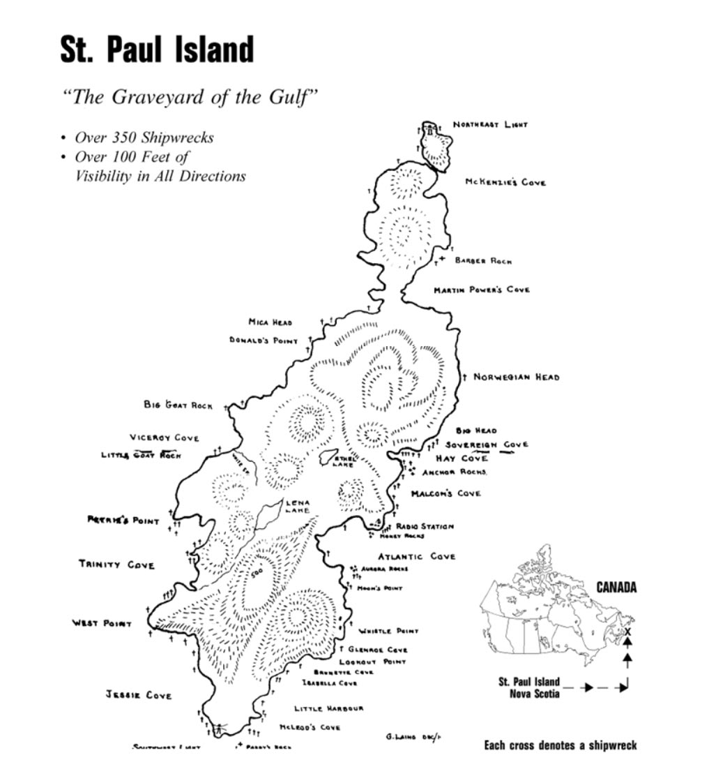 Today, if you examine a map of St. Paul Island, you will find that nearly every place on the map is named after a shipwreck that foundered there. Names like Norwegian Head, Viceroy Cove, Jessie Cove, Sovereign Cove, Isabella Cove, Glenroe Cove, Brunett Cove, Moon Point, Barbara Rocks, Aurora Rocks, and Money Rocks are all so named after the shipwrecks that have occurred there.
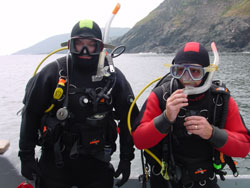
The diving on St. Paul Island is physically demanding, strenuous and at times psychologically challenging. The water surrounding the island is ice cold; the currents are strong and ever present. Diving here is very much a team effort and it requires discipline, experience, skill and commitment. You are totally dependent on the team and on a chase boat (zodiac) to pick you up after a dive. There is no shore diving what so ever from the island, only boat diving. This type of diving is not for everyone. Then there are the logistics of actually getting to and from the island. A journey to St. Paul Island will take six hours by road (Halifax to Dingwall), then a further three hours by boat (one way) out to the island. Once on a return trip to the mainland, the weather turned bad and it took us five hours to make port.
During another expedition, the "Meg and Kel" was engulfed in a sudden and violent rainstorm, during the night the wind changed direction 5 times. Our three anchors dragged and in a matter of minutes we were almost on the rocks. In the dead of a pitch black night, with the sea ragging all around us, we had to cut our lines with a fire axe, abandon our anchorage and make a run for the north side of the island. Minutes passed like hours as the "Meg and Kel" battled mountainous waves, high winds and heavy rain for the two hours that it took to find shelter on the north side of the island. That night served as a harsh reality check and a reminder to stay alert.
 Be advised that St. Paul Island is not an island to be taken lightly, if the unpredictable weather turns on you, it can be a hellish place. The logistical requirements are formidable and the planning for an expedition of this magnitude takes months.
For wreck divers and underwater photographers, the prize for challenging the elements and braving the logistics, is underwater visibility that often exceeds 100 feet in all directions and an enormous untapped potential for the discovery and exploration of virgin shipwrecks.
Divers visiting St. Paul Island will experience the unprecedented opportunity to view first hand, a seabed littered with the broken bones of hundreds of forgotten shipwrecks. On subsequent dives we have found huge pieces of steel ships in the form of boilers, engines, steel plates, anchors, propellers, etc. We have also discovered cannons, cannon balls, bronze spikes, dead eyes, and other pieces of old wooden wrecks from the 1700's.
 If you like shipwreck diving East Coast Canadian style, where the water is cold yet crystal clear. If you are up for the daily challenges and don't mind roughing it on a remote and uninhabited desolate island off Canada's rugged East Coast, an expedition to St. Paul Island is for you. Make no mistake, the diving is spectacular, but it is a privilege you will earn. It is a once in a lifetime experience.
It's hard to imagine what future expeditions are going to discover. The ice-cold waters preservative qualities make St. Paul Island a virtual time capsule of marine technology. It is a place where nature has remained undefeated; the contrasts are stark, the beauty is unsurpassed and it appears today almost exactly as it must have appeared 300 years ago. The underwater and surface photo / video opportunities are in a word "EXTRAORDINARY". A one-week expedition to St. Paul Island will allow the participant between 18 and 21 spectacular dives. For those of you who are up for a great adventure and a chance to dive into history, you will not be disappointed.
By This email address is being protected from spambots. You need JavaScript enabled to view it. / Staff Reporter
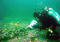 Contributed Underwater photographer Sam Millett shoots video of a newly discovered wreck near St. Paul Island off Cape Breton. |
For centuries, nobody wanted to go near St. Paul Island, about 23 kilometres off Cape North in northeastern Cape Breton. But an English diving team's discovery of a previously uncharted shipwreck 12 kilometres from the island's unforgiving shoreline might change that. Some people are predicting new-found enthusiasm among underwater buffs for what was, until the 1950s, considered one of Atlantic Canada's deadliest stretches of water. At the Maritime Museum of the Atlantic, Dan Conlin, curator of marine history, said St. Paul Island deserves its nickname Graveyard of the Gulf (of St. Lawrence).
"It rivals Sable Island in terms of ship-killing capacity," he said.
Hundreds of sailing ships were ripped apart by razor-like outcroppings of rock that line the little island's steep and ragged shores. Hundreds of seafarers - some sources suggest more than 1,000 - were killed in shipwrecks there before the introduction of modern navigational aids. But now experts agree the area has shown its significance as an underwater heritage resource, after the discovery of a well-preserved but broken-up 1850s wooden square-rigger.
An English military diving team completed an extensive site assessment this week, after members found the underwater wreckage during a recreational diving expedition last year. They kept quiet about it until last week. "It was the last day of diving when I came across the ship's bell from the Clymene dated 1861," said Maj. Andrew Reid, the team leader. "It is, as you can imagine, as exciting as you can get. When you're a diver, you dream of finding ship's bells." The 15-member team visited the little island to undertake an "archeological predisturbance" survey. "We returned to draw a map and outline what we had found," Maj. Reid said. "It was quite exciting, because every time we'd dive we'd find new things."
Besides the ship's bell - the recovery of which is considered a coup in marine exploration circles - the team identified a kettle, a cannon, anchors, sections of what appears to be a single metal mast, pottery fragments, bricks, the ship's windlass (the device used to raise anchor) and planks, spikes and sections of copper siding. As required by marine law, all the debris from the site must remain where it is for now. Most of the items located so far are remarkably well-preserved, mostly due to the near-freezing water temperature, depth of about 16 metres and remoteness of the site from the agitated waters of the island shoreline. Maj. Reid said the water at the site is remarkably clear - meaning an exciting underwater heritage resource could soon be added to the agendas of serious divers visiting Eastern Canada. But the underwater team found only the front of a sailing vessel estimated at 47 metres long.
The front of the Clymene landed on the uppermost portion of a deep undersea gully. Most of the rest of the ship tumbled into deeper waters, inaccessible without special equipment. Terry Dwyer, owner of Dive Quest in Halifax, said he's anxious to return to the site again next year, possibly with a mini-sub to see what remains of the rear portions of the square-rigger. "This wreck has not been documented and seems to be completely untouched," he said. The discovery of the Clymene occurred during an adventure tour put together by his diving business, and Mr. Dwyer is an advocate of this sort of tourism in Nova Scotia.
The discovery of the wreck shows the vastness of the underwater heritage resource made up of hundreds of sites all over Nova Scotia.
In sailing days, St. Paul Island had its share of tourists. But many of them didn't last long. The island did in any shipwreck victims that beat the odds and managed to get to shore. Behind a tangle of trees, there was no food and little water. St. Paul Island is positioned strategically at the entryway to the gulf, in what is still a busy shipping lane.
Back in the days before radar, fog, ocean currents, and inaccurate charts combined to give the island its killer reputation.
"Hundreds of vessels sank there, large and small," said the museum's Mr. Conlin. The advent of modern navigational aids in the 1950s reduced the island's menace to a topic of historical interest. Some members of the English expedition will continue researching the origins of the ship, but reports of the discovery are sure to funnel through to people in the diving community. But the sort of underwater plundering of shipwreck sites that occurred in the 1960s and 1970s is unlikely to happen now.
Robert Ogilvie, curator of special places for the Nova Scotia Museum, said shipwreck sites off Nova Scotia and other heritage resources have been protected since the introduction in the 1980s of the Special Places Protection Act. Controls were required to eliminate a feeding frenzy at these shipwreck sites by scavengers and souvenir hunters, Mr. Ogilvie said. "Divers now require a permit to explore these locations."
Only qualified divers, with an understanding of proper cataloguing and recovery procedures, have legal access to the sites, he said.
"We've gotten away from the treasure hunter sort of mentality that prevailed for a long time." Mr. Ogilvie said these underwater wreck sites are now recognized for what they are: heritage resources requiring protection. "The likelihood of finding treasure was always almost zero, but for a long time people were trashing some of these underwater sites in these futile treasure searches," he said.